Qualitative effects of clay on high-speed rail

This post is the second in a series delving into limitations that Leda clay may impose on HSR. In the last post, we introduced this material and the problem of acoustic shocks generated in the ground. In this post, we’ll look at how these shocks can damage the rail and nearby structures, and interfere with neigbouring land uses. In subsequent posts, I’ll post semi-quantitative calculations of the relevant rail speeds at which these effects become important, and overlay the map from the first post with the maximum attainable rail speed prior to soil improvement.

To start, I’ll apologize for some of the alarmism from the first post. However, the point stands that Leda clay is absolutely prone to subsoil failure. This doesn’t mean that sinkholes will suddenly form under the tracks, at least not in flat terrain.

One effect of soil failure would be settling at an enhanced rate. There are two principal mechanisms for settling in clay. One occurs somewhat slowly in areas where clay is present 8 to 15 m below the soil surface, which is from water being wrung out of the clay under increased pressure. This will occur under embankments, and especially under foundations for heavy overpasses, where an ultimate settling depth of a few percent of the height of the embankment can be expected. This is of lesser concern for a railroad on a shallow embankment, where any slow change in track elevation can be fixed by routine tamping.

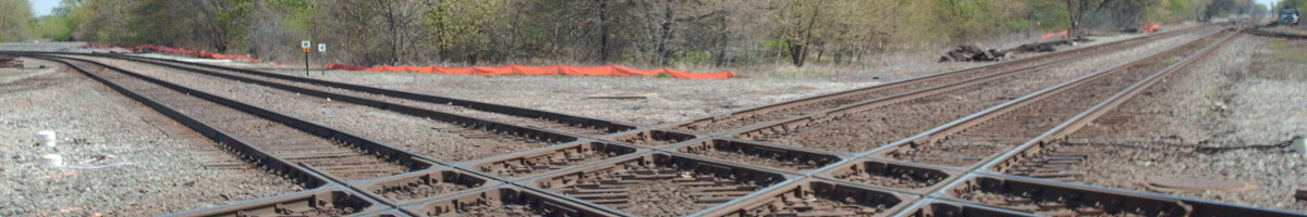
The other type of settling comes from failure of shallow soil under shear loads, up to a depth of about 5 m, either from uneven ground pressure, but particularly due to vibrations from passing trains. This type of failure can occur relatively quickly, liquifying the underlying sensitive clay1, and causing the rail embankment to sink into the equivalent of a water bed. This settling can also affect foundations for near-rail structures, overhead catenary in particular.

Other than settling, vibration can also cause the rail structure to degrade. If the ballast that holds the rails in place is strongly shaken, with acceleration exceeding 0.7 times gravity, it can flow, or at even lower accelerations, it can chip and lose it’s ability to hold the rail in place (reference). The liquified clay under the rail can also migrate upwards through other soil layers, commonly seen as ballast contamination and mud pumping.

Finally, vibration that propagates from the rail can affect neighbours. For trains travelling at slow speed, this vibration disipates quickly as one moves away from the rail line. However, at either the Raleigh wave speed, or at a critical speed for soliton propagation2, these waves can be focused into a single wave-front, whence the can propagate far from the railway.

Either through ballast degradation, subsoil failure, or impact outside of the railway, a speed limit of about 190 km/h for trains over these clay deposits is going to be needed. In the next post, I’ll go over some representative locations and calculations of the strain, surface acceleration, and vibration propagation to show how this limit can be defined.

  1. Sensitivity is the ratio of the shear strength of the clay when undisturbed versus after it’s been deformed or ‘remoulded’. ↩︎
  2. A soliton occurs when non-linear effects cause the wave speed for different wavelengths to converge to the same value. In Leda clay, this can occur when the dispersion relation that allows wave speed to increase with frequency and the speed of a wave is to be degraded as a function of strain. Thus, a short sharp wave pulse can catch up to a slower longer wave pulse, locally surpass a shear strain of about 1.5 parts in 10,000, and form something similar to an ocean breaker battering at the neighbour’s foundations. ↩︎
Posted in High-speed rail | Leave a comment

No supersonic trains for Ottawa to Montreal high-speed rail

UPDATE: A bug fix has corrected the quadrupled the clay depth shown in the map at the end of this post.

For Central Canada’s high-speed rail project, the Montreal to Ottawa segment seems like one of the simplest to design. Multiple existing and historic right-of-ways exist over relatively flat and rural terrain, and it seems to be simply an issue of reusing as much existing infrastructure as reasonable to keeps costs low, limiting the number of new grade separations required, and easing track geometries where the benefits exceed the costs to achieve a maximum speed of around 300 km/h. The most complicated part would be in determining how to address the needs of Canadian Pacific Kansas City freight when and where choosing to displace the company from it’s right-of-way.

There is however a complex set of hidden dangers.

Slide Risk

Growing up in British Columbia, the stories of toil and disaster that characterized the building of the railways through the Fraser Canyon, or the unstable shale roadbed of the Kettle Valley Railroad along the steep slopes of the Coquihalla River brought to mind rough terrain. Not the arrow-straight flats of the Ottawa area.

https://www.google.com/maps/embed?pb=!4v1748398543614!6m8!1m7!1s5_xBcSFqPx1bIvSrEngrrQ!2m2!1d45.31798679533181!2d-75.12173257159007!3f269.82462408461055!4f0.4656130588953431!5f2.8086994482653562

That’s before I learned about Ottawa and Quebec’s particularly unforgiving local sediment deposit, Leda clay. This is a mix of the ancient silt deposited at the bottom of the Champlain Sea, held together by salt. Once the salt leaches away and the clay is disturbed, it turns to liquid. Large parts of Ottawa and the Saint-Lawrence Valley are built on top of this, and it has wiped out entire villages.

In considering the arrow-straight rail line from the Streetview above, it directly abuts, but isn’t contained in, a known landslide risk area along the Nation River west of Casselman. Given that the line is still 350 m from the river’s edge and much heavier trains than will operate for HSR have operated along this line for a century without causing slides, it seems that this shouldn’t be a problem. However, there is a related problem.

Weak subsurface

Marine clay makes for a poor foundation material. It is expansive, variably hard or soft, brittle, and fatigue prone. The embankments or foundations for rail beds or structures such as overpasses should be expected to settle significantly in soft clay. The brittleness and fatiguing mean that setting can happen unevenly or after many years of service. The clay can also shift in response to changes in ground water, which can be instigated by fractures generated from ground settling.

There are ways to engineer around some of the failings of clay, either by reducing loading with raft foundations or light-weight fill materials, avoiding placing the railway on structures, mixing stabilizers, i.e. concrete, into the soil to make it more firm, or building deep foundations. Highway and rail engineers have learned to deal with this clay, but HSR brings an additional complication.

Supersonic trains

While the speed of sound in air is upwards of 1200 km/h, depending on altitude and humidity, and sound travels even faster longitudinally in dense materials, shear waves can be slower.

This will be familiar to anyone who knows about speed limits on ice roads. If a truck on an ice road approaches the speed of sound for the shear waves, or the system’s critical speed which can be as low as 20 km/h, it can create amplified shock waves that can buckle the surface, with frightening consequences.

In undisturbed Leda clay, this critical speed depends largely on the sound speed, which has been measured near 270 km/h1, such that HSR trains could be expected to produce shock waves. Shallower soft clay deposits may have even lower critical speeds.

There’s a well studied example of these sonic booms affecting a 200m long stretch of railway on a mix of marine clay and organic subsoils in Sweden near Ledsgard, where train speed was designed for 180 km/h. The resulting sonic booms affected both the infrastructure and neighbours. Such shocks could also progressively degrade clay under the railbed, lowering the critical speed and/or damaging nearby structures or banks. Best design practice is still debated, but where linear response of the subsoil can be assumed, a design speed of around 70% of the critical speed is often acceptable. Thus, any HSR line over untreated deposits of Leda clay would be limited to around 190 km/h maximum or less, regardless of track curvature.

While the critical speed in Leda clay may be higher than that found at Ledsgard, Leda clay has less damping than other soft soils. This both allows for more confidence in the linearity of the soil’s dynamics, but also that any vibrations generated will tend to travel farther from the railway, increasing impacts on nearby structures and users.

Extent of clay

Given the multitude of problems with Leda clay, a right-of-way that avoids thick near-surface deposits of clay vastly simplify HSR construction.

Unfortunately, such deposits are largely unavoidable in either the Vaudreuil-Soulanges areas west of Montréal, or the eastern approaches to Ottawa.

Looking at this map, I no longer wonder why Highway 417 deviates so far south from the Ottawa River.

In a later post, I hope to examine some of the consequences of these clay deposits on the design of Central Canada’s high-speed rail.

  1. At pressures reached at depths below about 10 m, water is force out of the clay, and the critical speed increases slightly, to around 360 km/h. ↩︎

Posted in High-speed rail | Leave a comment

The Cheap Way to Improve Reliability of the New York Subway

First, apologies for the crayon, but I hope to make a point.

Several recent power outages have each led to a nearly complete loss of service to the B-division of the New York City Subway. Even on a day-to-day basis, the subway is scourged by inconsistent service and crowded trains. The MTA is using this recent publicity to push for upgrading the subway’s signal infrastructure, making that very expensive and long-term solution seem like the way forward. While signal upgrades have merit, there is a much simpler way to avoid propagated delays in the subway: de-interlining, or as Alon Levy puts it, eliminating reverse branching. If the B, D, and E never crossed paths with other subway lines, the power outage at 7th Ave/53rd would have never affected the entire subway network. In addition to preventing system meltdowns, Alon’s posts point out that de-interlining allows for simpler scheduling, easier wayfinding, more frequent trains, reduced wear on switches, and reduced bunching of trains.

Such a de-interlined service could look like:


Continue reading

Posted in Transit | Leave a comment

Bus Tracker Data – Automated

Bus tracker data and plots for approximately half of the CTA’s routes are now available. For about half of these, plots and data are being automatically posted around 3 am every operating day. I will be working over the next month to expand the number of tracked bus routes, to start tracking the ‘L’, and to make the data easier to navigate.

As the CTA generously provides their Bus Tracker and Train Tracker APIs to developers including myself, I am releasing my derived data files and plots under the condition that they be used only to assist transit customers or to promote public transportation.

Enjoy.

Posted in Bus Tracker Data, Transit | Leave a comment

Detectable Warning Tiles

Detectable warning tiles, the tactile warning bumps at curb ramps, have been ADA mandated in new sidewalk construction since 2001. As per guidance from the Federal Highway Administration, detectable warning fields require good drainage and frequent sweeping in order to prevent the accumulation of water and debris. In Chicago, good drainage is famously difficult and the tiles rapidly deteriorate. Frost heave breaks fasteners and lifts many tiles out the sidewalk, causing tripping hazards, splashing, and an obstacle for those with reduced mobility.

Continue reading

Posted in Walking | 3 Comments

South Lakefront Corridor Transit Study — Shame!

In 2012 the Chicago Department of Transportation commissioned the South Lakefront Corridor Transit Study (“the report”) from 31st to 95th streets in response to very strong community interest in improving transit access, especially along the Metra Electric corridor. The report used dishonest assumptions to pan the idea of rapid transit service on the Metra Electric line, citing high capital and operational costs and low ridership.

This post will focus on Section 5 and Appendix A of the report.

Appendix A

Continue reading

Posted in Transit | 5 Comments

55th Street Streetscape Master Plan

In my previous post, I explored how complete streets priorities are reversed in 55th Street’s existing streetscape. At a meeting Thursday February 5, 2015, CDOT presented a fiscally unconstrained wish list of proposed streetscape improvements for community feedback.


Download

The topics in the comments below roughly follow the order of these slides.

Continue reading

Posted in Automotive, Cycling, Transit, Walking | 1 Comment

South Lakeshore Drive Express Buses

Bus tracker data for four of six Chicago’s south Lake Shore Drive express bus routes, the 2, 6, J14, and 28, were collected in November and early December 2014.

The J14 Jeffery Jump is branded as a premium bus route with features, such as improved bus station design, peak period dedicated lanes, and transit signal priority.  During peak periods, these features allow the J14 delivers reliable service with consistent travel times and limited bus bunching. Travel times on the two miles through the loop are nearly as long as the entire run along Jeffery Boulevard suggesting that the investment in the loop can further significantly improved travel times.

J14 - Jeffery Jump Thursday Nov 13, 2014

Continue reading

Posted in Bus Tracker Data, Transit | 4 Comments

55th Street Streetscape – Existing Conditions

On Thursday, I attended CDOT’s second public meeting for a new 55th Street Streetscape Master Plan in Hyde Park.  In this first of two posts, I’ll examine existing streetscape conditions on 55th street.

Three years ago, 55th Street received a road diet that reduced the barrier the street presents for pedestrians and allowed the installation of protected bicycle lanes. Before this change, 55th Street had not changed significantly since urban renewal when businesses were cleared from the street and it was widened into a fast four lane arterial street.

I feel that a master plan for 55th Street should not focus solely on the streetscape but also on land use. The street’s corridor acts as a barrier between the university and the residences and commercial activity in the northern and eastern parts of the neighbourhood and consumes some of the most valuable land on the South Side. However, land use is outside of the scope of CDOT’s plan and tangential to the scope of this blog. Rather than imagining 55th as a blank slate, let’s analyze a redesign of 55th street that improves safety and convenience for existing street users consistent with Chicago’s Complete Streets priorities.

Continue reading

Posted in Automotive, Cycling, Transit, University of Chicago, Walking | 1 Comment

Chicago’s Battery Electric Buses

Since October, the CTA has been operating two newly purchased battery electric buses. Since early December, I’ve gathered bus tracker data on the six routes that these buses are initially operating on: 7 – Harrison, 120 – Ogilvie/Streeterville Express, 121 Union Station/Streeterville Express, 124 – Navy Pier, 125 – Water Tower Express, and 157 – Streeterville/Taylor. I’ve also tracked some major north-south bus routes on the south side that I will comment on in a future post. As before, plots of the bus tracker data are available here. I’ve also added zipped csv files of the plotted position and speed data.

The electric buses, buses 700 and 701, have been replacing diesel buses on up to two peak-hour tripper runs per day each. Each run lasts between two and four hours and up to 35 miles. In the mornings, the buses have either taken run number 52 of route 157 inbound switching to route 121 at Union then the 120 in Streeterville, or they’ve taken run 54 of route 120, switching to route 121 in Streeterville, then route 124 for a round trip. In the afternoons, they’ve taken run 3 of routes 7, 125, and 121, or run 2 of route 7. On my plots of these routes, diesel buses are in red and electric buses in blue.

Continue reading

Posted in Bus Tracker Data, Transit | 3 Comments